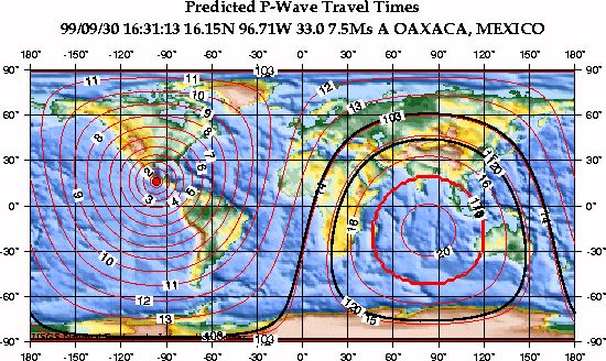
This map shows the predicted (theoretical) travel times, in minutes, of the compressional (P) wave from the earthquake location to points around the globe. The travel times are computed using the spherically-symmetric IASP91 reference earth velocity model. The heavy black lines shown are the approximate distances to the P-wave shadow zone (103 to 120 degrees).
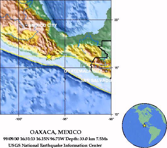
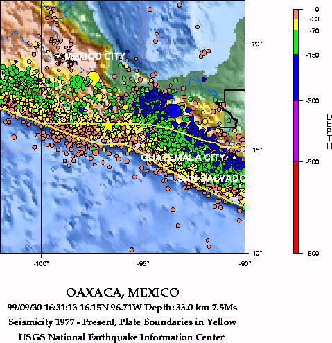
99/09/30 16:31:13 16.15N 96.71W 33.0 7.5Ms
OAXACA, MEXICO
The following is a release by the United States Geological Survey, National Earthquake Information Center: A major earthquake occurred NEAR THE COAST OF OAXACA, MEXICO about 35 miles (60 km) north-northwest of Puerto Angel or about 275 miles (440 km) southeast of Mexico City at 10:31 AM MDT, Sep 30, 1999 (11:31 AM CDT in Mexico). A PRELIMINARY MAGNITUDE OF 7.5 WAS COMPUTED FOR THIS EARTHQUAKE. The magnitude and location may change slightly as additional data are received from other seismograph stations. Some damage and casualties were reported in the state of Oaxaca.
1999 Earthquakes, Magnitude 7 and Greater
|
National Earthquake Information Center |
URL http://earthquake.usgs.gov/neis/bulletin/990930163113.HTML