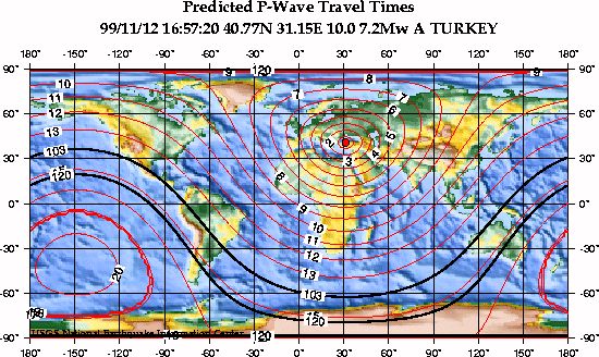
This map shows the predicted (theoretical) travel times, in minutes, of the compressional (P) wave from the earthquake location to points around the globe. The travel times are computed using the spherically-symmetric IASP91 reference earth velocity model. The heavy black lines shown are the approximate distances to the P-wave shadow zone (103 to 120 degrees).
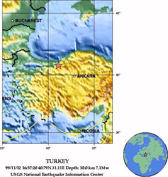
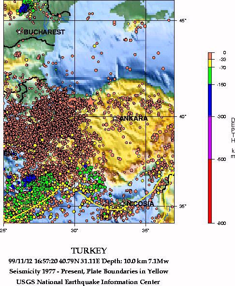
99/11/12 16:57:20 40.79N 31.11E 10.0 7.1Mw
TURKEY
The following is a release by the United States Geological Survey, National Earthquake Information Center: A major earthquake occurred 45 miles (70 km) east of Adapazari or 105 miles (170 km) northwest of Ankara, Turkey. at 10:57 AM MDT today, Nov 12, 1999 (6:57 PM local time in Turkey). A PRELIMINARY MAGNITUDE OF 7.2 WAS COMPUTED FOR THIS EARTHQUAKE. The magnitude and location may change slightly as additional data are received from other seismograph stations. This earthquake is located about 70 miles (110 km) east of the magnitude 7.4 mainshock on August 17 which killed over 17,000 people and injured another 50,000. No reports of damage or casualties have been received at this time for today's earthquake. However, this earthquake may have caused substantial damage and casualties due to its location and size.
|
National Earthquake Information Center |
URL http://earthquake.usgs.gov/neis/bulletin/991112165720.HTML