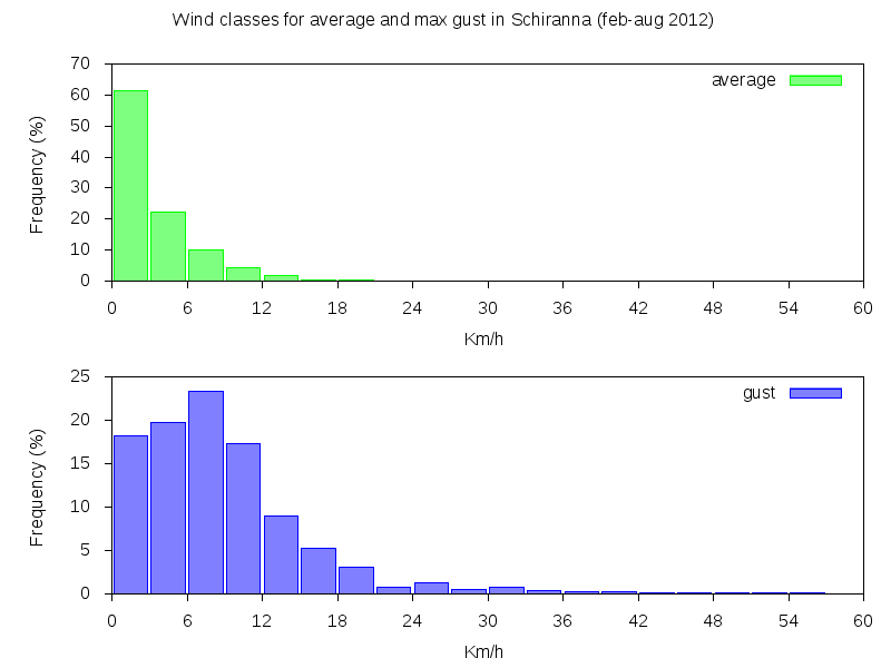
Wind classes for average speed and gusts (Schiranna Feb-Aug 2012)
The average wind speed over Varese lake is often quite low and, as is shown by the hystogram, there is more than 60% time of calm or wind speed less than 1 m/sec. This is expecially true during the night. In daytime during fair weather some breezes rise, depending on lake boundary insolation and orientation. Strong winds reaches the lake only few days per month, usually due to downslope Northern wind that cames from the Alps. In such conditions waves can soon develop on the surface. Thunderstorms in summer (may-september) also can originate strong irregular gusts. The maximum wind speed during a thunderstorm recorded so far at Schiranna meteorological station was 29.2 m/sec (105 Km/h) on 2012 aug 22.
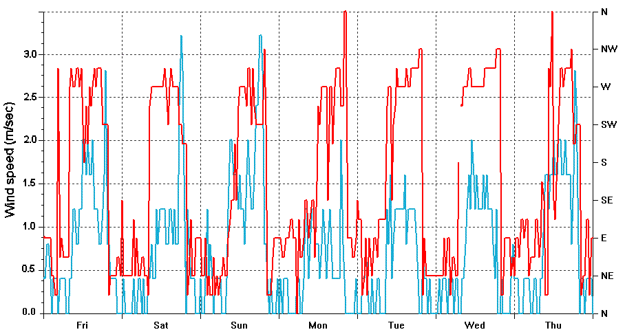
Breezes speed (blue) and direction (red) in Schiranna during a week of fair weather (10-17 aug 2012)
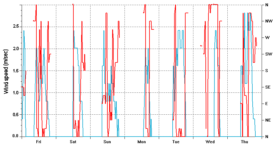
Breezes speed (blue) and direction (red) in Bodio during a week of fair weather (10-17 aug 2012)
Example of breeze recording during a week of fair weather (10-17 aug 2012) for the stations of Bodio (left) and Schiranna (right), respectively at the North edge and South edge of the lake. Wind speed is blue, wind direction is red.
A further analysis of wind breezes is relevant because these are frequent and constant winds over the lake. Breezes depend on the surrounding mountains (expecially in the North side) and are particularly sensitive to the orientation of the lake boundaries. Breeze direction, for example, is not the same for Bodio and Schiranna meteorological station. Bodio lies in the southern part of the lake. Daytime breezes are mainly from N to NW starting around 10 am to 18 pm and reaching an average speed of 2 m/sec.
In Schiranna, thermal driven breezes are more regular due to the presence of the Campo dei Fiori mountain in the North. Direction is mainly SW-W during the morning, W at noon and W-NW in the afternoon. Average speed is 1.5 to 2 m/sec.

